Trail On foot Les Rives - Randonnée du 07/06/2022 à 09:14 - Photo

Randonnée du 07/06/2022 à 09:14

© OpenStreetMap contributors
Length
Length
14.3 km
Max alt
Max alt
794 m
Uphill gradient
Uphill gradient
212 m
Km-Effort
Km-Effort  
17.1 km
Min alt
Min alt
721 m
Downhill gradient
Downhill gradient
212 m
Boucle
Boucle
Yes
Creation date :
2022-06-09 13:00:01.926
Updated on :
2022-06-12 13:33:06.089

(0 Reviews)

On foot
On foot
3h53
Difficulty : Easy
Walking
Walking
3h53
Difficulty : Difficult

Scan this QR Code to open this trail in the SityTrail application

FREE GPS app for hiking

Logo SityTrail SityTrail

IGN / Geographical institutes

Download SityTrail from the App Store Download SityTrail from Google Play

Logo SityTrail SityTrail World

The world is yours!

Download SityTrail from the App Store Download SityTrail from Google Play Download SityTrail on Huawei AppGallery

About

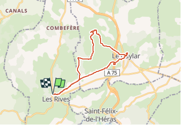
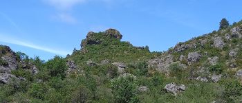
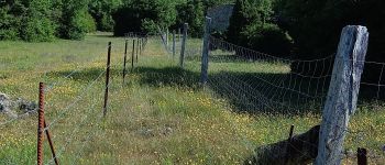
Trail On foot of 14.3 km to be discovered at Occitania, Hérault, Les Rives. This trail is proposed by canardDenis.

Description

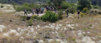
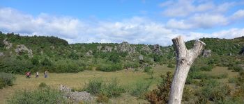
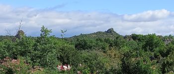
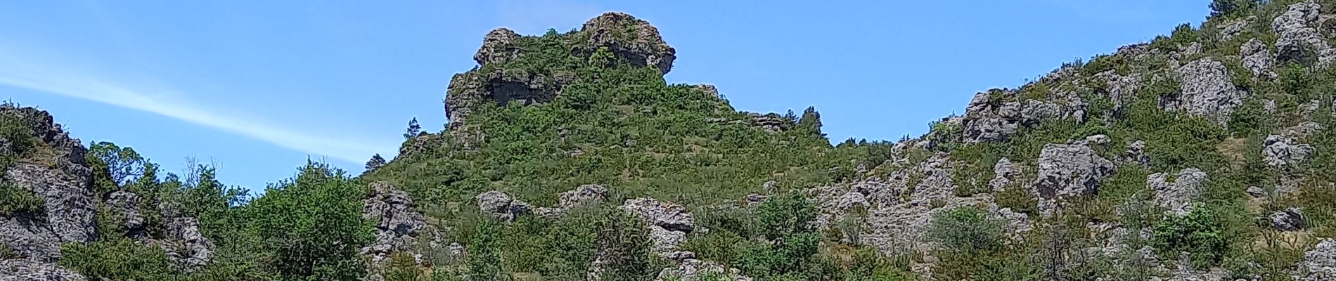
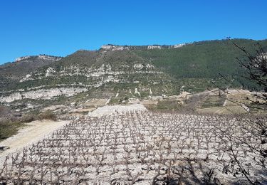
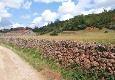
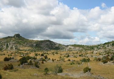
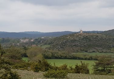
Au départ du village des Rives, boucle dans le Larzac vers le rocher du Lion (roc de Servières) puis à la découverte du village du Caylar et retour. Le larzac en ce début Juin est tout en fleurs et en herbe

Elevation profile

Photos

Points of interest

Point of interest Le Caylar - Chapelle et Calvaire - Photo
canardDenis
Point of interest Le Caylar - arbre sculpté  - Photo
canardDenis
LE CAYLAR 
Point of interest Le Caylar - rencontré piste et suit vers Le Caylar  - Photo
canardDenis
Point of interest Le Caylar - prairie - Photo
canardDenis
LE CAYLAR 
Point of interest Le Caylar - Roc du Lion  - Photo
canardDenis
LE CAYLAR 
Point of interest Le Caylar - film Maleville - Photo
canardDenis
LE CAYLAR 
Point of interest Le Caylar - traversée piste  - Photo
canardDenis
Point of interest Le Caylar - traversée pistes - Photo
canardDenis
Point of interest Le Caylar - passer barbelés  continuer hors piste à gauche  - Photo
canardDenis
Point of interest Le Caylar - suivre clôture  - Photo
canardDenis
LE CAYLAR 
Point of interest Le Caylar - retrouver sentier nouvelle barrière  - Photo
canardDenis
Point of interest Le Caylar - quitter sentier à droite passer  barrière  - Photo
canardDenis
Point of interest Le Caylar - barrière prendre à droite sentier après barrière  - Photo
canardDenis
Point of interest Le Caylar - laisser piste à droite continuer piste à gauche  - Photo
canardDenis
Point of interest Les Rives - laisser piste à gauche continuer tout droit piste  - Photo
canardDenis
Point of interest Les Rives - piste à gauche  - Photo
canardDenis
LES RIVES 
Point of interest Les Rives - Parking Les Rives - Photo
canardDenis

Positioning

Country:
France
Region :
Occitania
Department/Province :
Hérault
Municipality :
Les Rives
Location:
Unknown
Start:(UTM)
521534 ; 4854682 (31T) N.

Trails nearby

Trail Walking Pégairolles-de-l'Escalette - Les terrasses de Pégairolles - Photo
Walking
mdauzat

Walking

Easy
(2)
Pégairolles-de-l'Escalette, Occitania, Hérault, France
10.2 km | 14 km-effort
2h 58min
Yes
Trail Walking Le Caylar - Sud-Larzac - Photo
Walking
VacheKiri67

Walking

Difficult
(1)
Le Caylar, Occitania, Hérault, France
18.4 km | 22 km-effort
6h 4min
Yes
Trail Walking Lauroux - cirque de labeil - Photo
Walking
mrclic34

Walking

Easy
(2)
Lauroux, Occitania, Hérault, France
10.7 km | 14.1 km-effort
3h 4min
Yes
Trail Mountain bike Le Caylar - Traversée VTT FFC Larzac- Méditerranée - Le Caylar à Agde - Photo
Mountain bike
tracegps

Mountain bike

Difficult
(1)
Le Caylar, Occitania, Hérault, France
181 km | 226 km-effort
20h 0min
No
Trail Cycle Le Caylar - Le Coeur d'Hérault à vélo n°9 - Le cirque de Navacelles et les grands causses - Photo
Cycle
tracegps

Cycle

Difficult
(2)
Le Caylar, Occitania, Hérault, France
62 km | 77 km-effort
4h 45min
Yes
Trail Walking Pégairolles-de-l'Escalette - Falaises de l'Escalette - Photo
Walking
GUIDE
nadinebondoux

Walking

Difficult
Pégairolles-de-l'Escalette, Occitania, Hérault, France
16.3 km | 25 km-effort
6h 1min
No
Trail Walking Lauroux - Lauroux (cirque de Labeil, l'Escandorgue) - Photo
Walking
coulombf

Walking

Easy
(1)
Lauroux, Occitania, Hérault, France
13.3 km | 18.5 km-effort
5h 22min
Yes
Trail Walking Cornus - Sorgues - Photo
Walking

Walking

Difficult
(1)
Cornus, Occitania, Aveyron, France
13.4 km | 19 km-effort
3h 59min
Yes
Trail Walking Le Caylar - du Caylar à la Couvertoirade  - Photo
Walking
GUIDE
amiral13

Walking

Very easy
Le Caylar, Occitania, Hérault, France
16 km | 20 km-effort
5h 45min
Yes


Close
My subscriptions